Climate change and hurricanes: Is Irma a sign of things to come?
As Irma leaves a ruined Caribbean in its wake, Hurricanes Katia and Jose are also on the move - but is the worst yet to come?

Monday 11 September 2017 08:21, UK
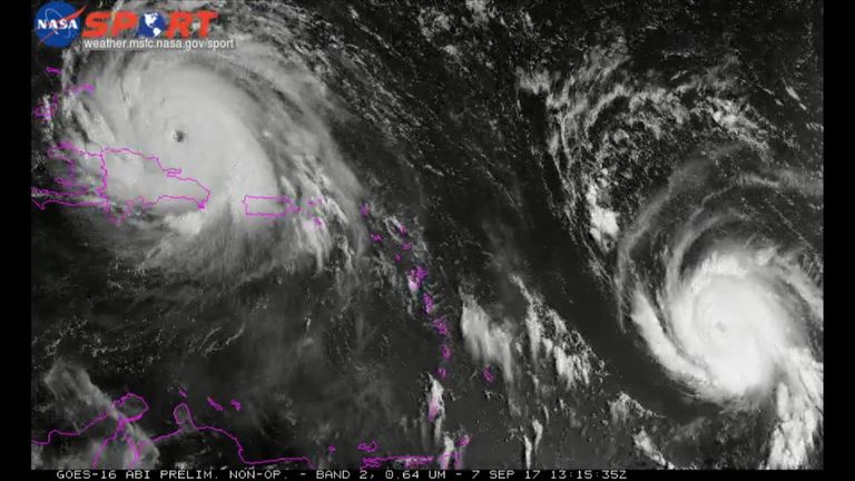
Hurricane Irma is the most powerful storm ever recorded over the Atlantic.
Did climate change make it more deadly? Maybe a little but not as much as it will future storms.
A warning, though: it's very hard to apply general models of climate change to a specific hurricane like Irma. And we don't have any evidence yet that climate change has caused an increase in activity.

In an overview of current research, the Geophysical Fluid Dynamics Laboratory (GFDL) at the US National Oceanic and Atmospheric Administration (NAOO) says: "It is premature to conclude that human activities and particularly greenhouse gas emissions that cause global warming have already had a detectable impact on Atlantic hurricane or global tropical cyclone activity."
Indeed, if you look at hurricane records since 1878, there is a small upward trend in the number of hurricanes but it's not significantly distinguishable from zero. It can also be explained by things like better observation systems rather than climate change.
Looking at models for future climate change, the good news is that, by the end of the 21st century, there will likely be fewer hurricanes per year.
The bad news: those hurricanes will be a lot more powerful - by 2% to 11%, depending on which model you use and potentially more destructive, according to the GFDL.

That's for three reasons.
First, hurricanes will bring more rainfall. Warm air can "hold" more water: water vapour is predicted to increase by 7% for every degree centigrade of warming so when hurricanes hit, they bring much more rain meaning more flooding.
Second, sea levels are rising. That means that storm surges reach further inland than they once did again leading to more flooding.
Third, sea waters will continue to get warmer. This is important for hurricanes in particular.
Hurricanes are fuelled by warm air rising from the sea. Higher water temperatures mean warmer air - which means bigger, more powerful hurricanes.
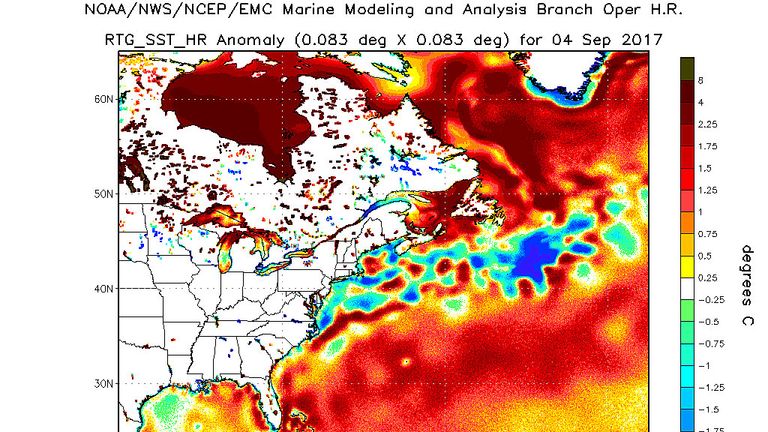
That partly explains why Irma is so powerful: Atlantic waters have been unusually warm. This chart, from earlier this week, shows them 0.5°C to 1.25°C above average.
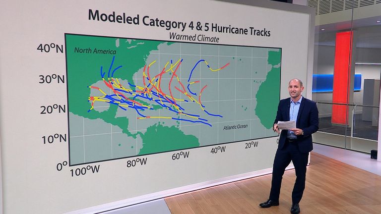
This is what the path of those more powerful storms will look like, compared with today.

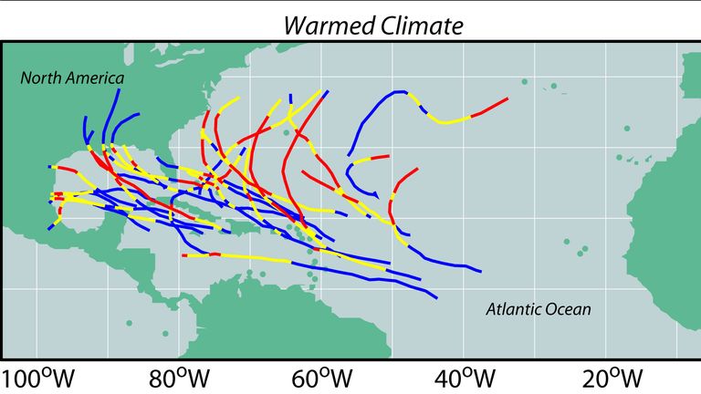
So: there will be fewer storms, but they will be more powerful.
Will those two even each other out, in terms of the impact of hurricanes? Probably not: the GDFL projects (roughly) a 30% increase in total damage from Atlantic hurricanes by 2100.
As devastating as Hurricane Irma is, worse is likely to come.